Routeplanning: RV 27 Rondevegen over Venabygdsfjellet (Ringebu@E6 - Hanestad@RV 3)

Mitsubishi i-MiEV Forum

Help Support Mitsubishi i-MiEV Forum:

This site may earn a commission from merchant affiliate links, including eBay, Amazon, and others.

elekTrond

Active member
Joined
Jun 5, 2016
Messages
32
Location
middle of No(r)way
:idea: Wanted: advice regarding SOC and trip pace:

I plan a summer project crossing a mountain pass peaking at 1070 metres above sea level, including a 14 % slope. Click here for an orthophoto map overview of the route.

Routeplanners:
goingelectric.de/stromtankstellen/routenplaner/1287110
jurassictest.ch/GR (add Ringebu and Hanestad, Norway manually)

Tweaks:
  • GoingElectric: i-MiEV, 80 km range, 80 % SOC, CHAdeMO only
  • GreenRace: i-MiEV, (11xx kg empty weight), 13 kWh battery (~80 % SOC)
  • feel free to add relief map mode or sat/ortho for an impression of the terrain

Tour / Start: Ringebu, Norwegen (Here be both Grønn Kontakt and Fortum@Kiwi services)
Return / Ziel: Hanestad, Norwegen (Fortum @ Hanestad Vertshus)
Distance: 89 km ( 89/1.6 ~ 55,6 miles)
Elevation / Steigung: 1418 Hm, Gefälle: 1234 Hm, maximale Höhe: 1070 m

GreenRace reports a 14 % gradient, averaging between ~6-12 % the first 14 km of the pass. The same 14 km leg rises a continuous 800 height metres.

I'll arrive first QCDC after 100 km (/1.6 = ~62.5 mi). The whole 250 km (155 mi) trip go from Gjøvik to Tynset, Norway. (Write "Gjovik".) Leaving Ringebu with 80 % SOC is not enough, but 100 % takes too much time and money. I pay NOK 2.50,- or ~30 cents U$D a minute. :?

I welcome input from more seasoned drivers on how to attack this mountain part of the route. :D
If you have similar or even better EV routeplanners, bring it! :mrgreen:

Some scenic pics:
http://www.nasjonaleturistveger.no/en/routes/rondane?gallery=Rondane+-+Bildegalleri
 
elekTrond, thanks for posting. I like that routeplanner!

My initial thoughts -

1. What a beautiful venue for an excursion!
2. The good news is that you should be able to travel as slowly as you wish
3. Don't even think of starting out without 100%SoC; try to figure out a less-expensive charging scheme from 80% to 100%. You never know what unexpected detours you may have to make.
4. A climb of over 800m is serious, but the good news is that you get to the top in the first third of your trip, and it's all downhill after that. If you get into trouble in that first climbing leg, you can always turn around and go back downhill. When you get to the top, the RR will be a very low number, which you will find disconcerting, but you should be able to judge from your fuel gauge as to whether the rest of the trip is doable from that point forward. Plan on taking your time climbing.
5. Hope your hypermiling skills are well developed.
6. Looks like there are some villages along the way, so you should be able to get a charge somewhere if really needed.

NOK 2.50, (0.30USD) a minute is ridiculous, as the i-MiEV charger only draws 3kW. I would try to find some other method. Perhaps take a power meter with you and offer to pay some private party for the demonstrated energy you absorbed at whatever the going rate is for electricity.

Wish you all the best!
 
Thanks to you for your swift reply, Joe! ;)

Let me clear up that last thing first. NOK 2.50,-/min is for 50 kW DCQC aka "type 4 (CHAdeMO), mode 4". Had to look it up, since I believe you US guys dub it "level 3" or something? I also had to correct myself for using "QCDC" instead of the proper DCQC abbreviation. :oops:

en.wiki/IEC_62196
en.wiki/CHAdeMO

When I switch over to a (16 Amp) type 2 mode 3 outlet, they only charge NOK 0.60,- per kWh, per 15 min initiated. That should be like U$D 0.30,- for an full hour of ~3 kWh's. At home I pay like $0.12/kWh, so thats okay except for the time spent topping off the battery. :roll:
I also earn a stepped rebate @ gronnkontakt.no which helps.


Nett__TLC3410_4907666a.jpg


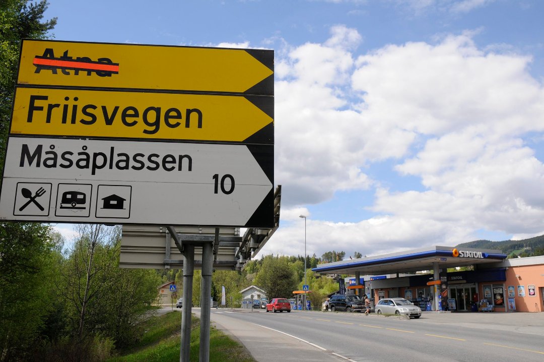
Now, back to planning mode (!). There is a shortcut too, peaking at 1,158 metres above sea level. Which makes for a 968 m rise from Ringebu@190 m. :eek: It's Friisvegen aka FV385 (county road #385). Not sure (yet) if it's any better regarding energy consumption though.

HJB_9172web.jpg


Here I eyeballed the distance over Friisvegen to roughly 40'ish km or 25 mi. Then the last pass to Hanestad makes for an additional 20 km, or ~60 km in total. Versus the other 89 km route via road 27 and 219. Decisions, decisions ... :?

Wait, what? According to GreenRace it's 67 km. I managed to plan it in GR with the following steps:
A) Ringebu, Norway
B) Friisvegen
C) Random waypoint by clicking in GR map (at Friisvegen)
D) Random waypoint where 385/634 joins up with 219.
E) Hanestad

Turns out the road number change from FV 385 to FV 634 where Friisvegen crosses the county border. *facepalm*

Anyway, by averaging 60 km/h, I may now arrive target @ 27 % SOC, even with 80 % or 13 kWh at start. If I choose to follow GR's automatic speed of unholy 23 km/h, I'll consume just 35 % SOC. That's g-r-e-e-n! :mrgreen: :lol:

Except from a short, but steep 14 % at start, max. uphill rise seems to be mostly ~6 %, probably due to the twisty, winding road sections. At the 46 km mark, there is a nice regen'ing downhill slope at -12 %. :cool:


Just some random sources with pics:
https://en.lillehammer.com/things-to-do/friisvegen-and-vinjevegen-p631493
http://www.hafjellresort.no/en/content/mountain-roads-lillehammer-region-norway
http://ringebu.com/no/destinasjoner/friisvegen/
https://www.visitnorway.com/listings/friisvegen-and-vinjevegen/6348/
http://jordbruen.blogspot.no/2012/06/bente-og-roger.html (the newly weds)

HJB_9237web.jpg
 
Back
Top